The Thousand Islands do not reveal themselves in one grand view. They arrive as decisions: which side of the next granite shoulder, how much room beneath the keel, whether the freighter will alter the water before it reaches you. That intimacy is the region’s gift and its warning. A crew that arrives with current charts and a modest route finds one of America’s richest cruising grounds. A crew steering from attraction to attraction by phone screen alone is working much too hard.
River history in every channel
The St. Lawrence River was a transportation corridor long before the border divided it. Indigenous communities traveled and lived along these waters; later the river carried military campaigns, timber, immigrants and commerce. The nineteenth-century summer estates added a different layer. Wealthy families built island houses, boathouses and landmarks intended to be approached from the water, not photographed from a highway turnout.
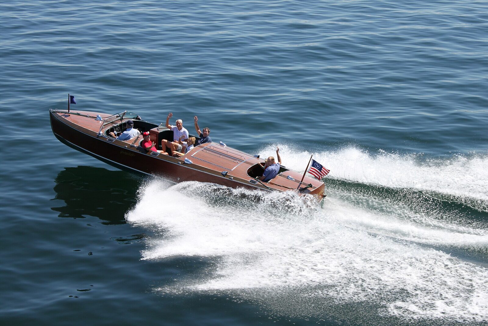
The opening of the St. Lawrence Seaway in 1959 made ocean-going commercial traffic part of the modern landscape. That is why a small cruiser can pass a Gilded Age cottage in the morning and watch a deep-draft freighter slide through the main channel in the afternoon. The Antique Boat Museum in Clayton connects these eras particularly well, turning varnished runabouts and working craft into a readable history of river life.
Clayton or Alexandria Bay?
Clayton is the better base for crews who want the Antique Boat Museum, walkable meals and a measured start. The harbor feels connected to the working river without the intensity of the busiest tour-boat scene. Alexandria Bay places Heart Island and Boldt Castle close at hand and offers more concentrated entertainment, but traffic in the approaches can be busy and wakes arrive from several directions.
Choose based on the first morning, not the final dinner. A boat kept in Clayton can make a rewarding eastbound run through island water. A crew centered in Alexandria Bay can reach Boldt Castle early, before tour traffic peaks. Trailer storage, launch geometry, slip exposure and fuel access matter more than whether a hotel lobby photographs well.
Arriving by boat and reading the river
Boats entering from Lake Ontario meet a river that increasingly asserts itself eastward. Crews arriving from the Erie Canal or Oswego route must account for lock schedules and the open-water crossing that precedes the islands. Local trailer boaters should launch fully provisioned; groceries are easy ashore, but repeated docking turns a cruise into errands.
Current changes how the boat turns, stops and docks. Practice ferry angles and approach into the combined effect of wind and current whenever possible. Watch fixed objects on shore to see lateral movement that the bow can hide. The chartplotter is essential here, yet visual piloting remains equally important because granite shoals, small craft and fast-moving tour boats inhabit the same tight spaces.
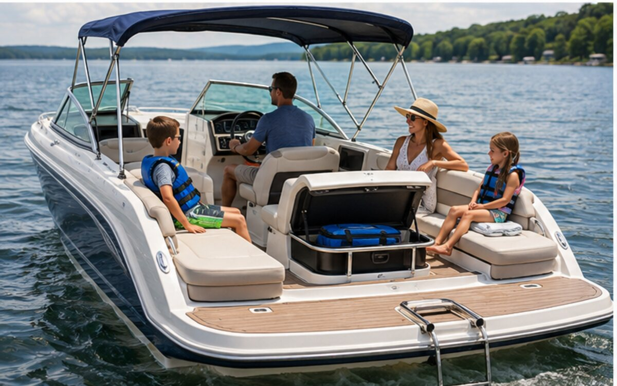
Docking at Boldt Castle
Heart Island provides extensive docking for private pleasure craft, but availability and procedures remain subject to operations, weather and traffic. Approach slowly, prepare lines and fenders before entering the basin and follow staff direction. The passenger responsible for stepping ashore should understand that jumping with a line is not a docking plan.
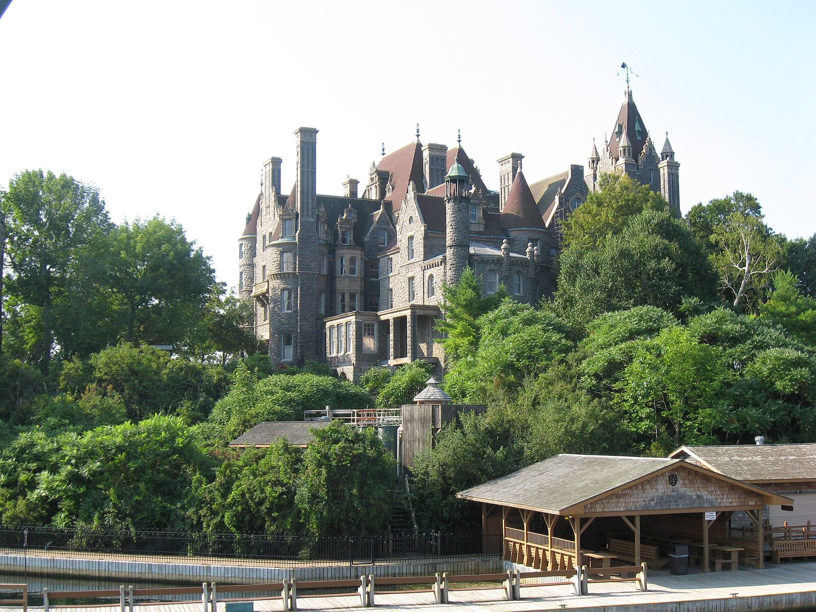
Allow real time for the visit. Boldt Castle is not a ten-minute photo stop; the buildings and grounds tell the unfinished love story of George Boldt’s ambitious island estate. Passports and customs requirements matter if the day crosses into Canadian waters or includes Canadian landings. Being physically near the border does not erase it. Review current U.S. Customs and Border Protection and Canada Border Services Agency procedures before departure, and make sure every person’s documentation matches the plan.
Docks, marinas and fuel
Clayton and Alexandria Bay both offer marina services, public or commercial transient options and fuel in the broader harbor areas. Operating hours narrow outside midsummer, and an icon on a chart does not promise fuel today. Call the intended stop and a backup. Ask about depth, approach, pumpout, shore power and whether a reservation includes a specific slip or merely a place in the basin.
Commercial fuel on the river carries the usual waterfront premium. The larger cost is poor planning: running far down-current for a meal, then discovering the return requires more throttle into wind and river. Start full, calculate the return leg conservatively and treat one-third remaining as a planning prompt rather than a victory. Carry basic spares, because a propeller damaged by granite does not care how close the nearest town appears on a phone.
Anchorages and quiet water
Protected coves exist throughout the region, but “protected” depends on wind direction, current and passing traffic. The lee of an island can be comfortable while the hook holds and miserable after the wind clocks. Check the chart for depth, submerged cable areas and bottom contours, then leave more swing room than a small inland-lake anchorage would suggest.
Canadian and American shorelines include private property, park land and regulated areas. Do not infer landing rights from an empty dock. If the plan includes an overnight, reserve a marina or legal park destination rather than improvising at dusk. A quiet lunch hook, set and verified in daylight, is the best introduction. It lets the crew watch freighters and wildlife without creating an international paperwork problem.
Weather, current and freighter wake
The St. Lawrence can look settled while a distant front reorganizes the afternoon. Southwest wind against river current creates a short, awkward surface in exposed reaches. Thunderstorms reduce visibility and make the island maze far harder to read. Check the marine forecast, not only a town forecast, and save the route offline before leaving reliable cellular coverage.
Large commercial vessels are constrained by channel and draft. Give them room long before the encounter feels close. Their wake can arrive after the ship appears to have passed, refract around islands and reach a docked boat from an unexpected angle. Secure hatches, keep passengers seated during close encounters and avoid crossing ahead. The view is better from a safe, predictable position.
Navigation hazards that deserve respect
Granite is the defining hazard. Some shoals are obvious, others lie beside water that appears equally navigable. Follow current charts and aids, understand the buoyage system and resist the temptation to copy a local boat through an unmarked cut. Local knowledge belongs to the operator who has it; it does not automatically transfer to the boat behind.
Current can sweep a slow boat toward the wrong side of a marker while the captain studies the screen. Assign one person to help watch outside in busy passages. At night, shore lights make navigation marks harder to isolate and small islands merge into a dark mass. A first visit is better planned in daylight, with the boat secured before the crew is tired.
Food and family stops
Clayton’s waterfront puts the Antique Boat Museum and village restaurants within a compact walk. Wood Boat Brewery is a casual shore-side choice, while several village kitchens serve river views or regional comfort food. Alexandria Bay offers a larger concentration of seasonal dining and treats close to its docks. Names, dock privileges and hours change; verify before planning a hungry crew around one table.
For families, alternate concentration with release. A museum visit, castle walk and short island picnic are enough for one day. Children who have spent an hour staying seated in a narrow channel need space to move. Keep snacks and water available even when lunch is supposedly close. The region’s best lesson for young boaters is visible everywhere: boats are transportation, history and responsibility at the same time.
Wildlife, legends and photography
Bald eagles, osprey, herons and waterfowl use the island edges. Photograph wildlife from a distance that does not change its behavior. River otters and other mammals may appear briefly; waiting quietly produces better moments than chasing them around a cove. Keep food secured and never turn a wild shoreline into a feeding station.
Local storytelling ranges from smuggling tales and river pilots to the romantic tragedy of Boldt Castle. The most useful legend is the “river rat”: a person whose knowledge comes from observing current, weather and rock over a lifetime. For photographs, early light on varnished boats in Clayton, a broad view of Heart Island from the water and the evening silhouette of the Thousand Islands Bridge provide three very different readings of the region.
Best months and what the trip costs
Late June through early September offers warmest weather and the fullest operating schedule. July and August bring tour traffic, premium rooms and crowded weekends. June water can be cold; September mornings can be magnificent, with reduced traffic and sharp visibility, but services begin scaling back. Fog and cool nights are part of shoulder-season cruising, not small-print exceptions.
Budget for marina dockage or mooring, fuel, possible launch and trailer storage, museum and castle admissions, meals, ice and documentation-related plan changes. A transient slip is often worth the cost for a first visit because it provides a known return point and removes the pressure to find a legal overnight anchorage. Reserve early for holiday weekends, then keep a cancellation plan if wind makes the boat unsuitable.
A seven-day cruise in miniature: the two-day plan
Day one: Depart Clayton after an early systems check, cruise an island route at displacement speed where appropriate and spend enough time at the Antique Boat Museum to understand what you are seeing on the water. Eat in town, top off fuel and review the next day’s wind. An evening harbor walk is more useful than a late unfamiliar run.
Day two: Leave early for Heart Island. Visit Boldt Castle before the heaviest tour traffic, then choose a protected lunch stop based on that day’s wind. Return by a different charted route only if comfort and fuel permit. If conditions deteriorate, shorten the run and take a commercial tour. Good seamanship includes recognizing when another captain’s boat is the smarter boat.
Don’t miss—and the habits locals notice
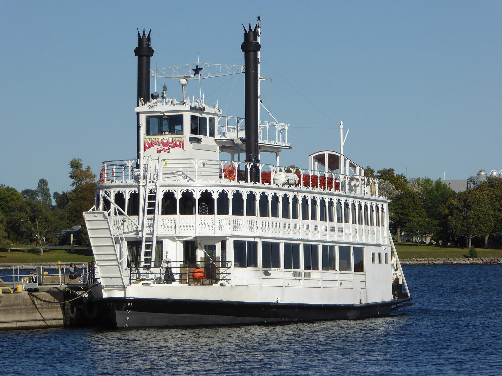
Don’t miss: the Antique Boat Museum, Boldt Castle approached from the water, one close but respectful look at a passing freighter and an early run when the river still reflects the islands. Each reveals a different part of the region’s identity.
Insider habits: rig fenders on both sides before a new harbor; know the border plan before casting off; keep paper identification dry; never cut a corner simply because another wake disappears behind it; and greet dock staff on the radio with a clear boat name and length. Competence here looks quiet. The captain who seems unhurried usually did the planning the night before.
Frequently asked questions
Do I need a passport to boat in the Thousand Islands?
You may boat near the international boundary without landing, but entering Canadian waters, landing in Canada or returning to the United States can trigger reporting and documentation requirements. Check current CBP and CBSA rules for the exact route and every passenger before departure.
Can private boats dock at Boldt Castle?
Boldt Castle states that extensive docking is available for private pleasure craft. Availability and procedures can change, so check current visitor information and arrive with lines and fenders prepared.
Is the Thousand Islands difficult for a first-time captain?
The area is manageable with current charts, conservative routes and daylight, but granite shoals, river current, tour traffic and commercial vessels demand more attention than a simple open lake.